Maps
There are a large number and wide variety of historical maps available online. The maps below were collected from various sources and are but a small collection of what is available
Library of Congress American Memory Collection
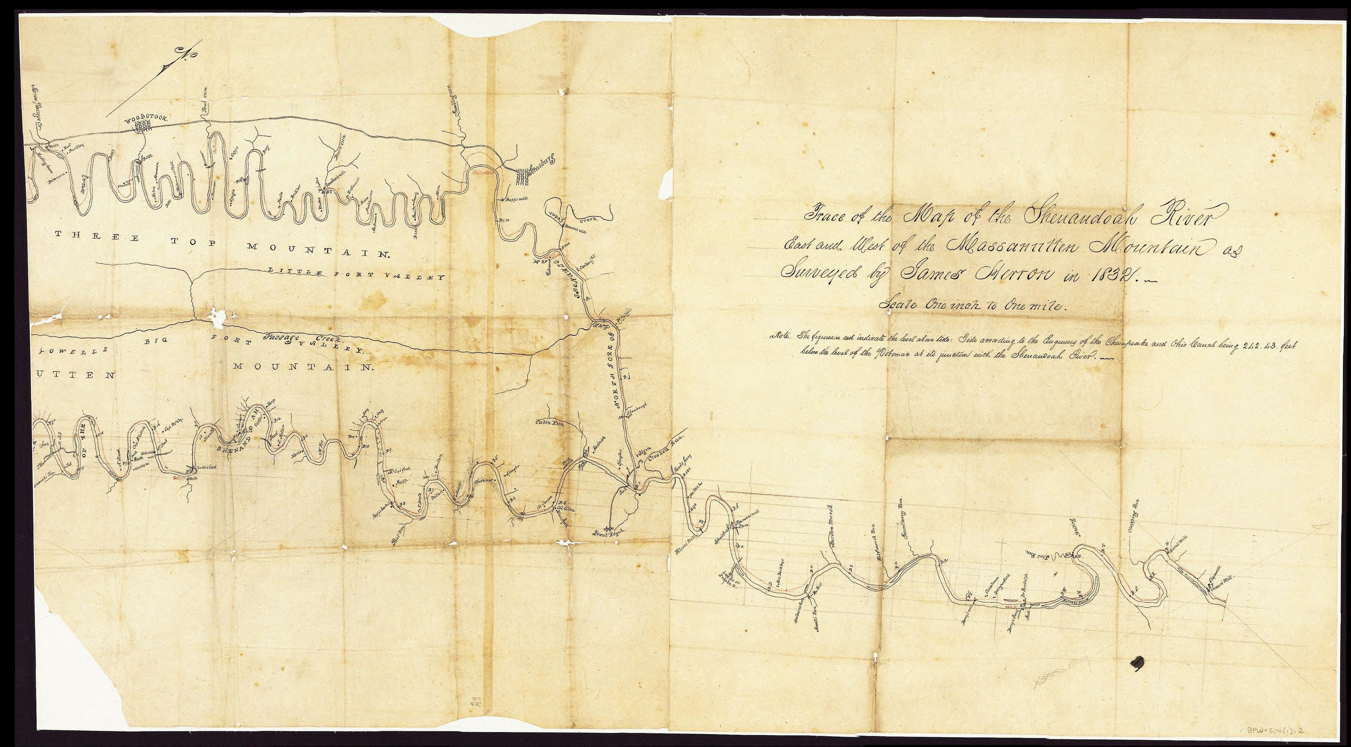
1832 Shenandoah River Valley
The map below is from a survey of the Shenandoah River in 1832 by James Herron. The first two images make up the full map. They are pieced together from over 80 smaller parts each. The third is small section showing the bend in the river where Fort Egypt is located. The house marked as “A Weaver” is at the approximate location of Fort Egypt and probably is Fort Egypt.
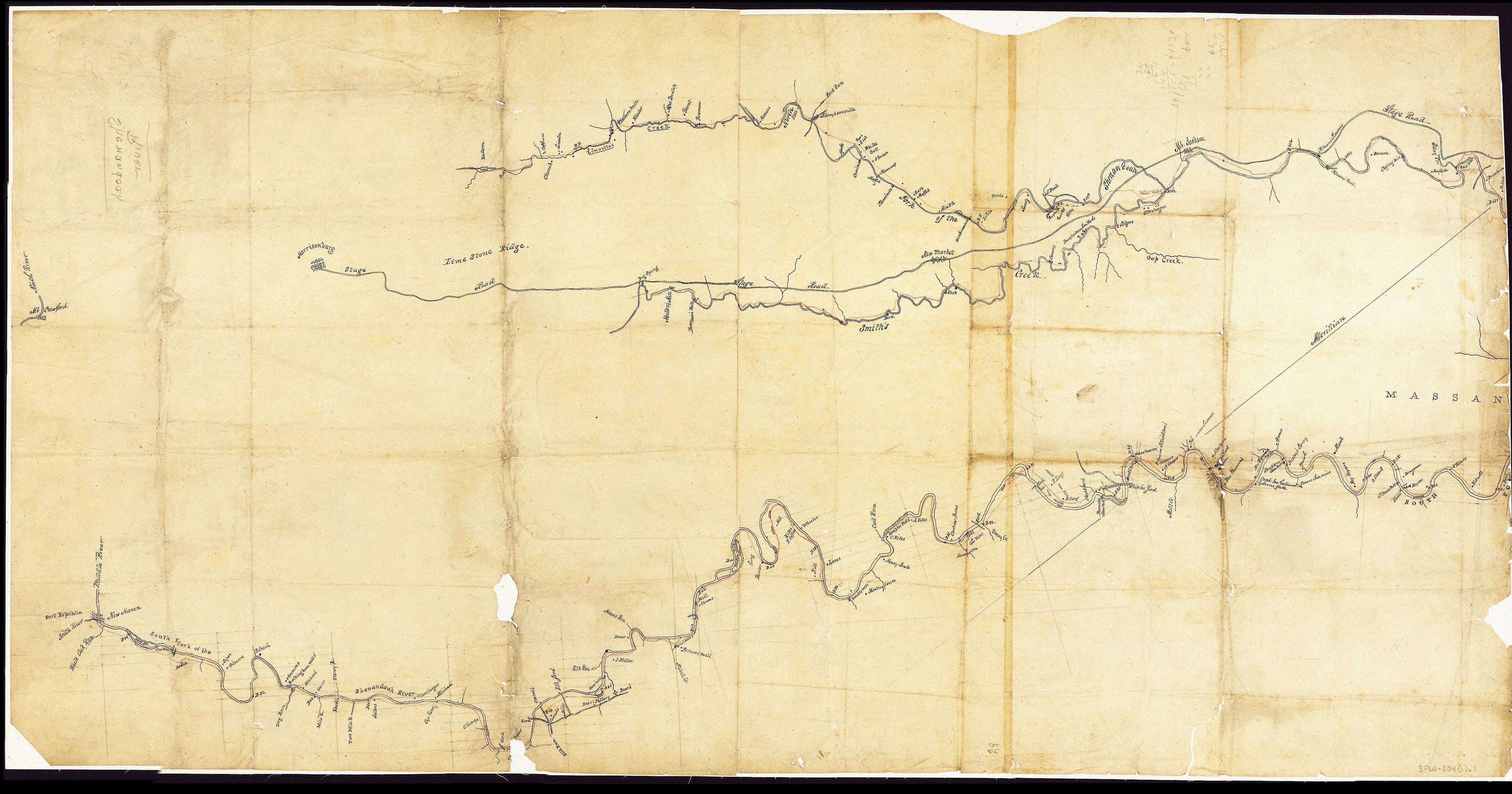
1832 Shenandoah River Valley Pt 1
1832 Shenandoah River Valley Pt 2
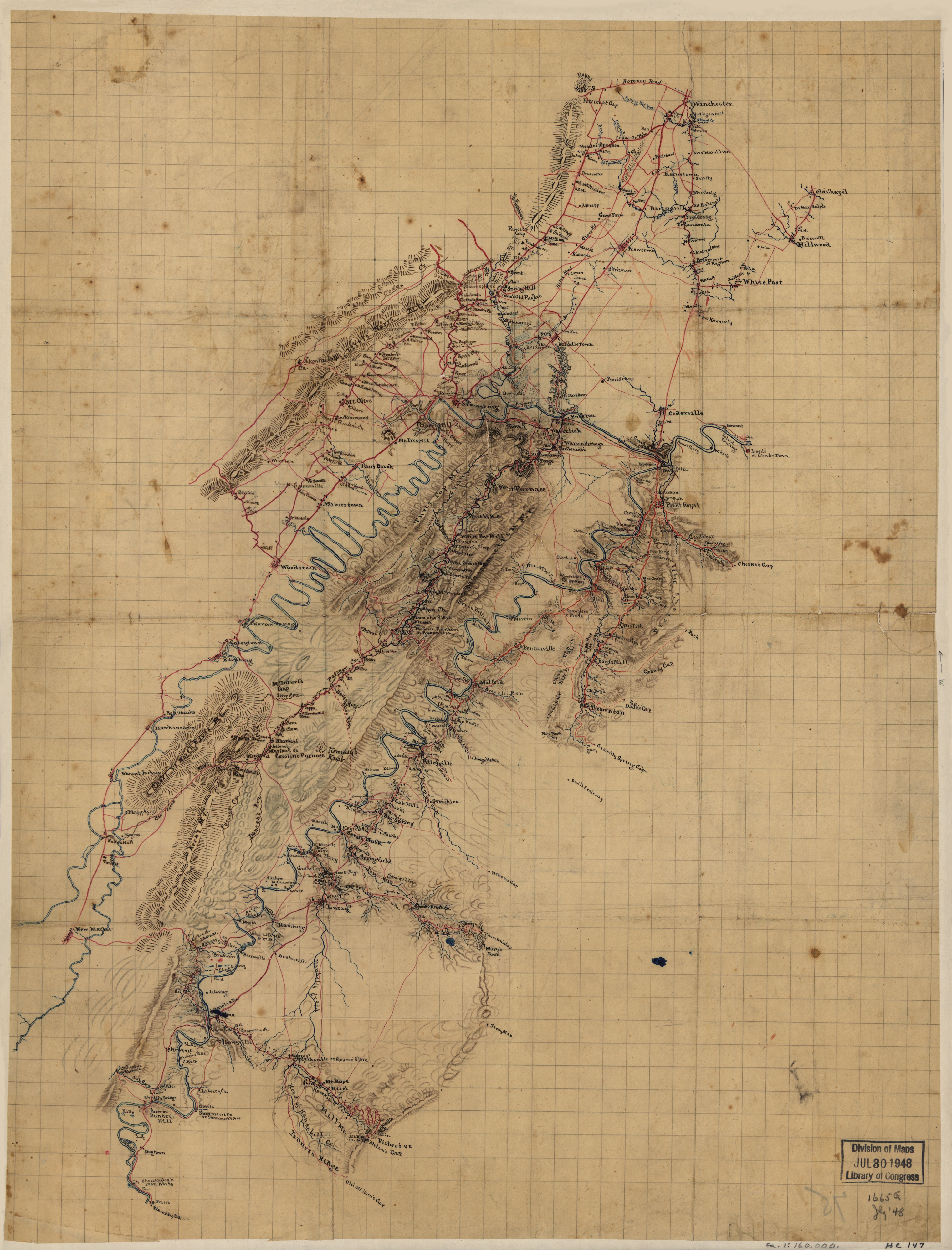
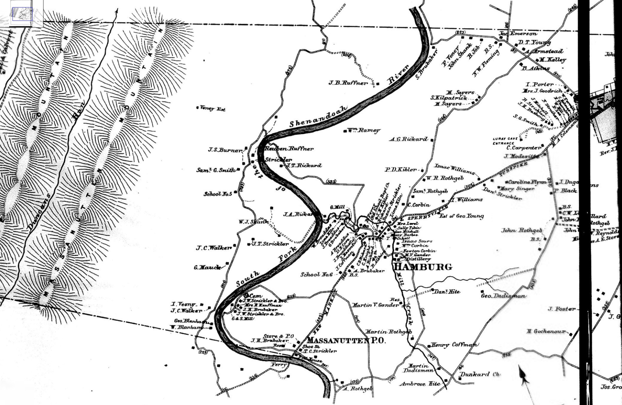
1862 Shenandoah River Valley
This map below from 1862 was found at the Library of Congress web site. The entire map shows the Shenandoah River Valley from Winchester to Staunton. It is very large and it is recommended it be downloaded and viewed off-line versus opening it in the web browser. The other two images show the area around Fort Egypt at two different zoom levels. The house marked “Shank” is Fort Egypt. The owners name at that time was actually spelled “Shenk”.


1862 Shenandoah River Valley - Zoom
1862 Shenandoah River Valley
1794 Map of Virginia
The map below is from 1794. It is located in the David Rumsey collection (though it is cataloged in the collection as being from 1795) as well as at The University of Alabama.
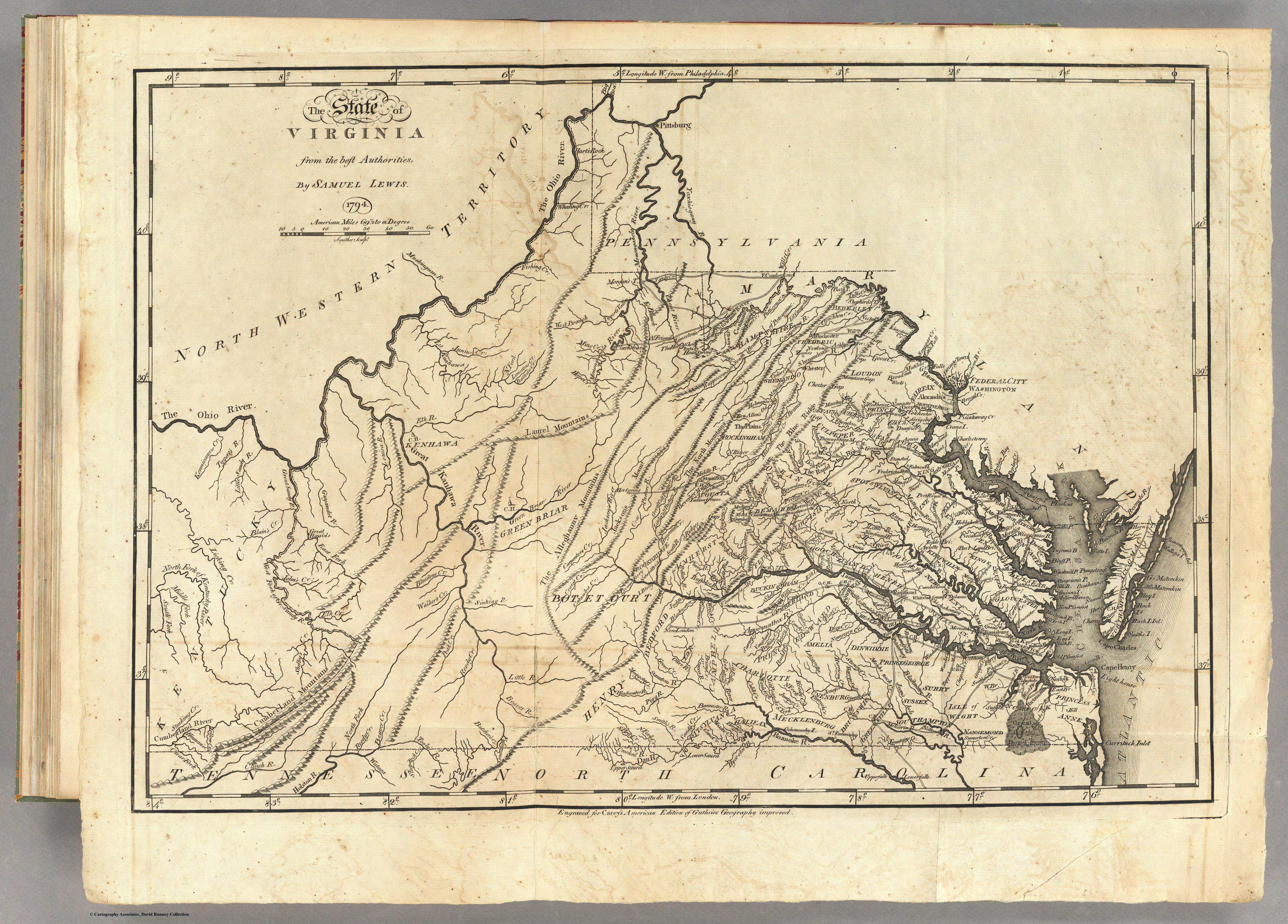
1794 Map of Virginia
Massanutten Book Map
The map below is from Massanutten by Harry Strickler. Fort Egypt is marked as #19 in “Strickler Acres”. The map is Mr. Strickler’s attempt to plot the Northern Neck land grants and early deeds in the Massanutten area. Harry Strickler’s map, while very good, takes some undue liberties with the surveys.
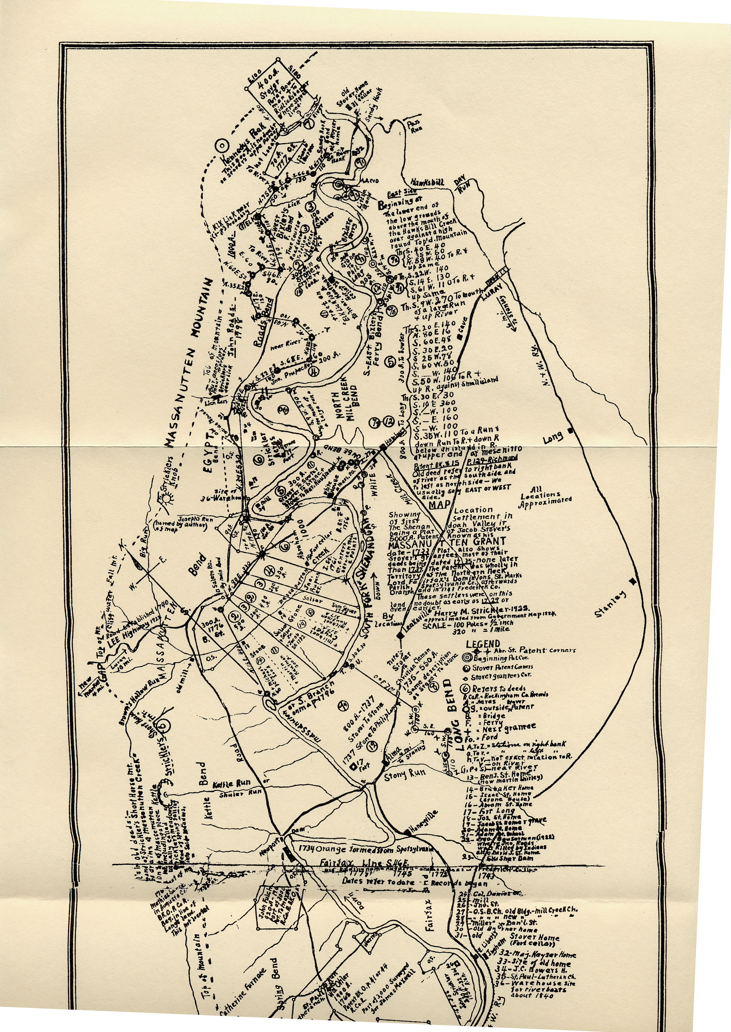
Map from Massanutten Book
1860’s Shenandoah River Valley
The map below of the Shenandoah River Valley is from the 1860’s and was obtained from the Library of Congress website. The house marked “Stover” across from Mill Creek is probably Fort Egypt.
1860’s Shenandoah River Valley
1884 Massanutten/Hamburg
The image below part of an 1884 map that was posted at www.wendtroot.com. This is a section of a larger map.
1884 Massanutten/Hamburg
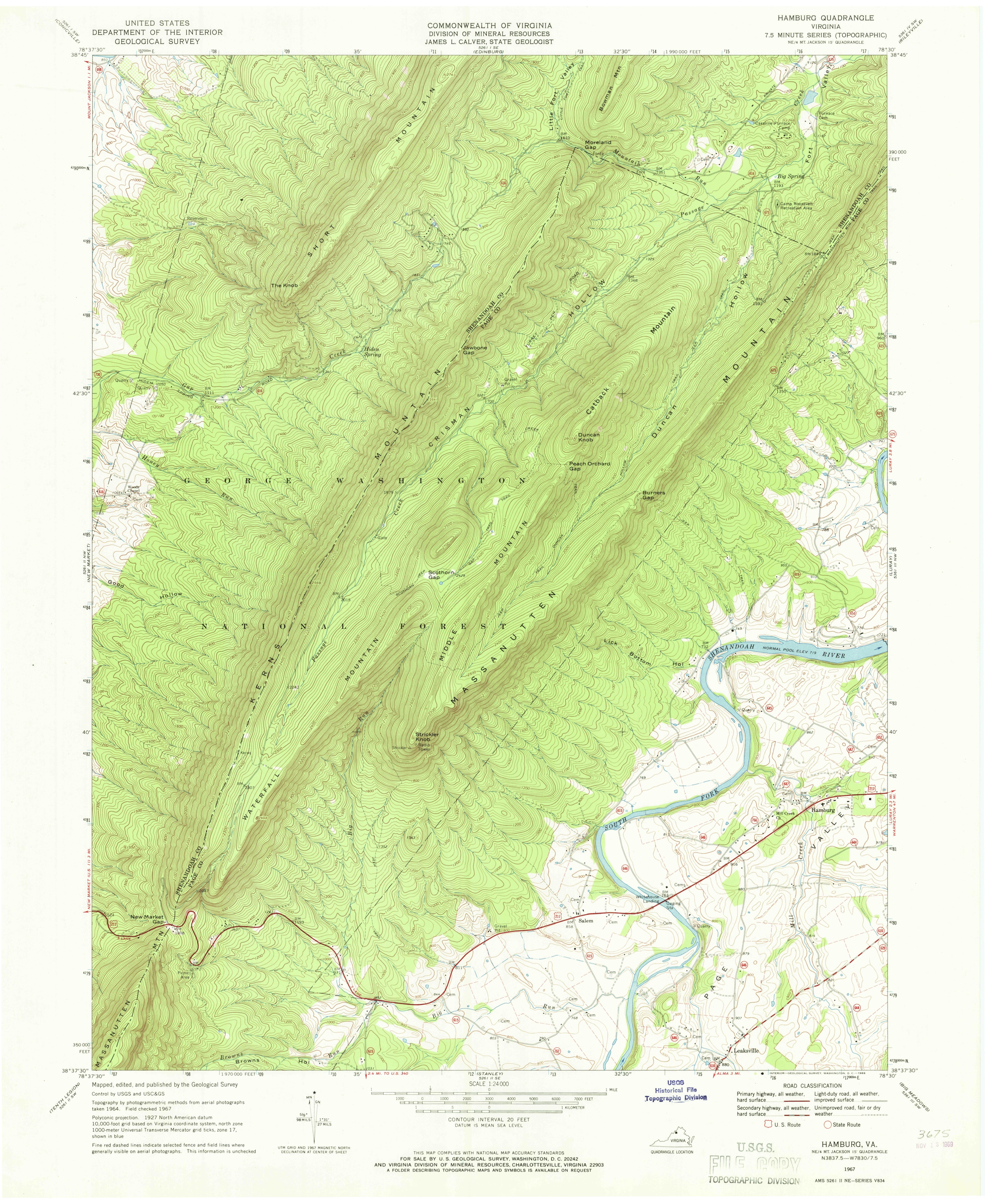
USGS Topographical Surveys
Below is a section from a USGS topographical grid. Fort Egypt is nearly dead center and is the first house northwest of the “K” in “South Fork”.
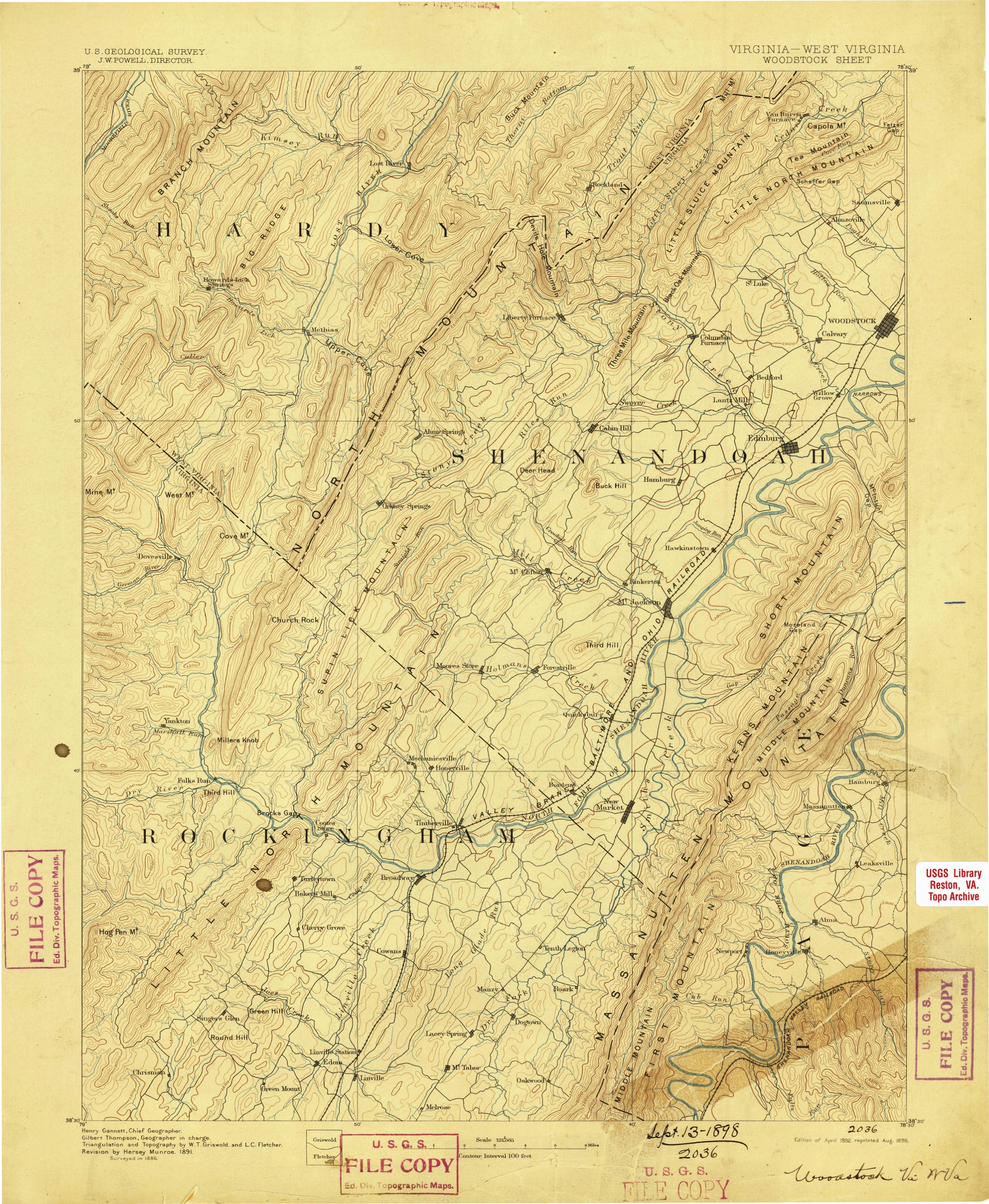
USGS Topo Woodstock VA 1892
USGS Topo Hamburg 1967
USGS Topo Hamburg 1997
USGS Topo Hamburg 2016
1736-1737 Northern Neck
Below is a survey of the Northern Neck of Virginia, the lands belonging to Lord Fairfax. The “Pecked Mountain” is now called the Massanutten Mountain. The “South River” is now called the south fork of the Shenandoah River
1736-1737 Northern Neck
Other Maps
Below are some other maps that might be of interest

1773 British Empire in America
1755 British Middle Colonies in North America
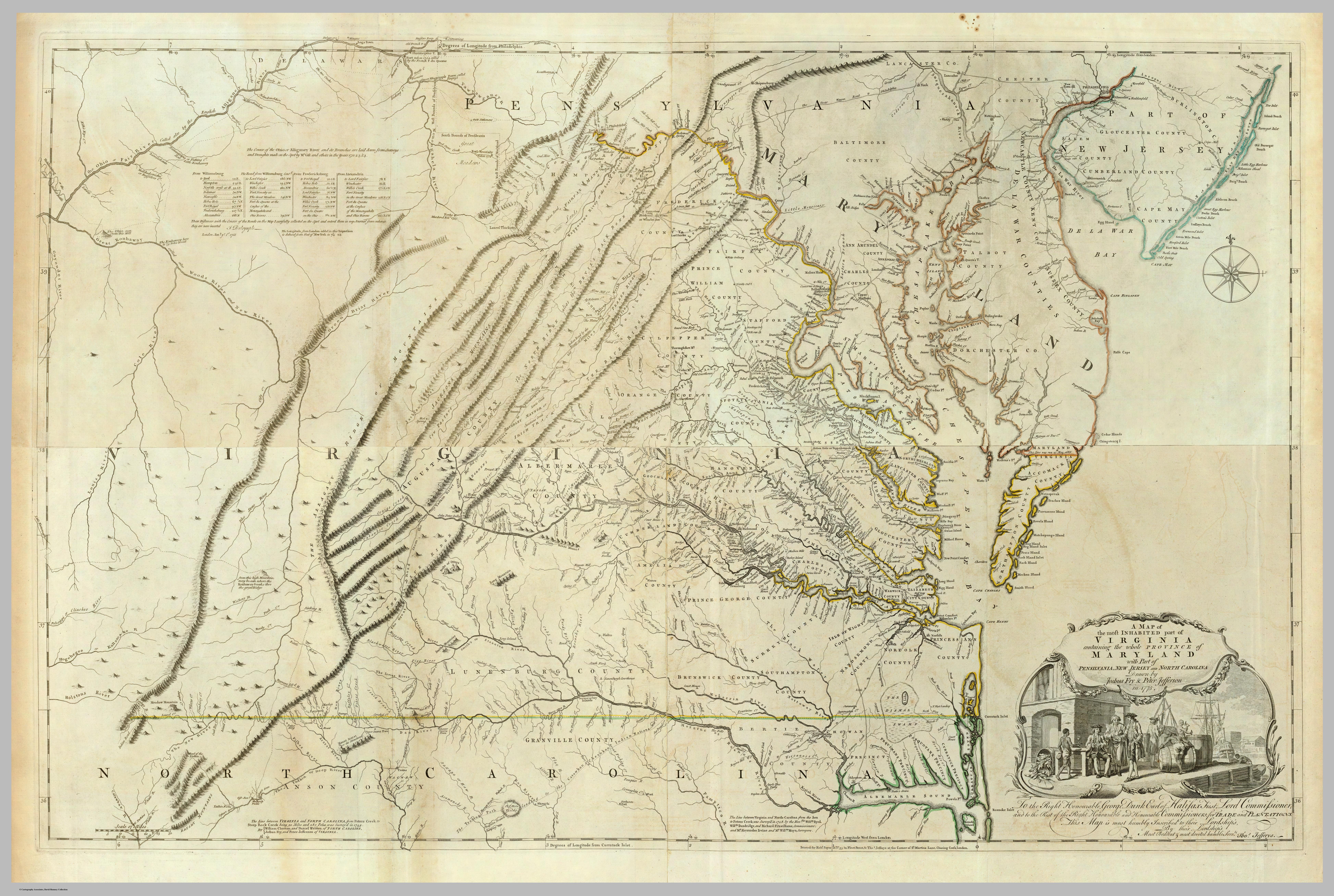
1775 Map of Virginia and Maryland
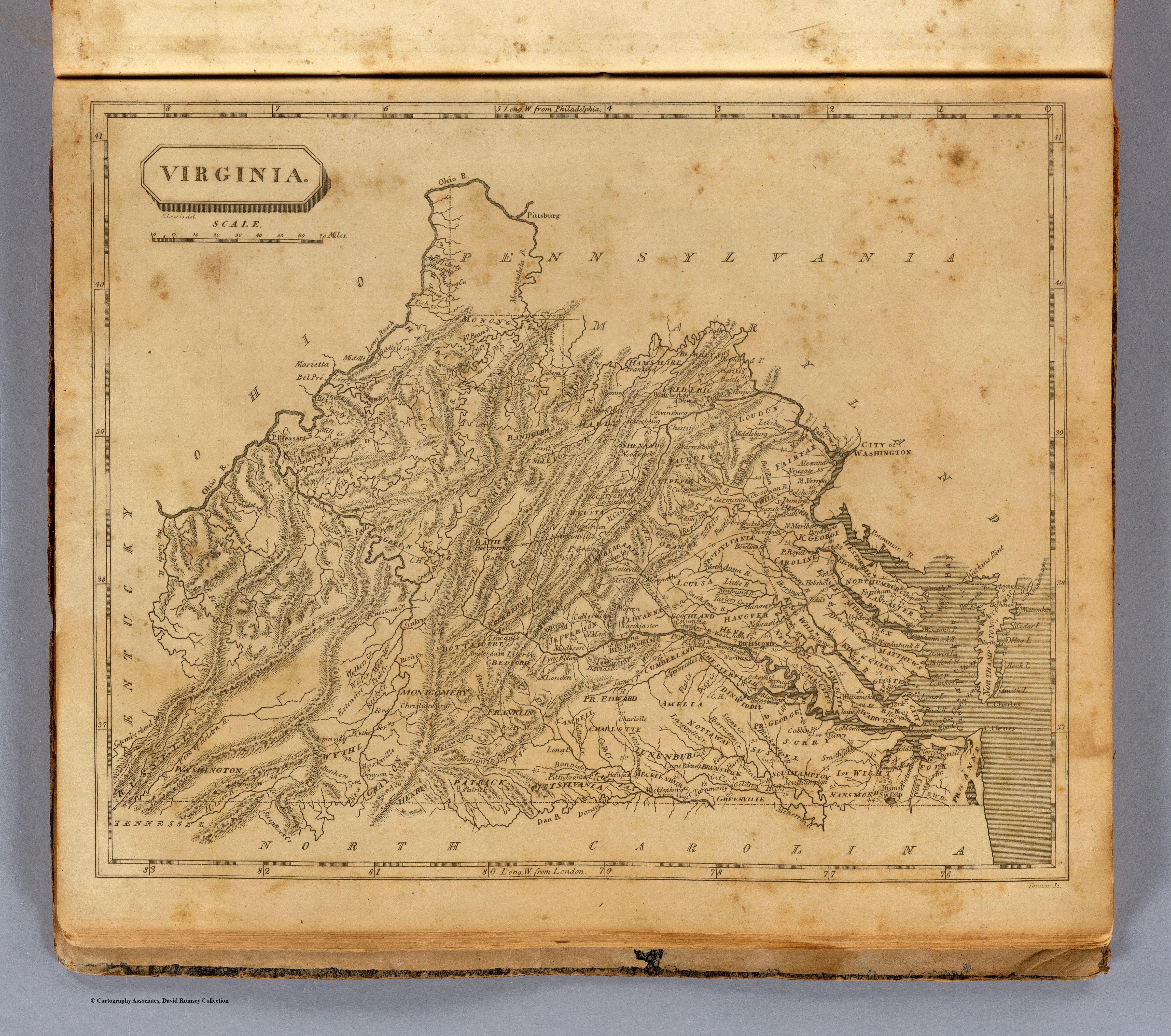
1812 Map of Virginia